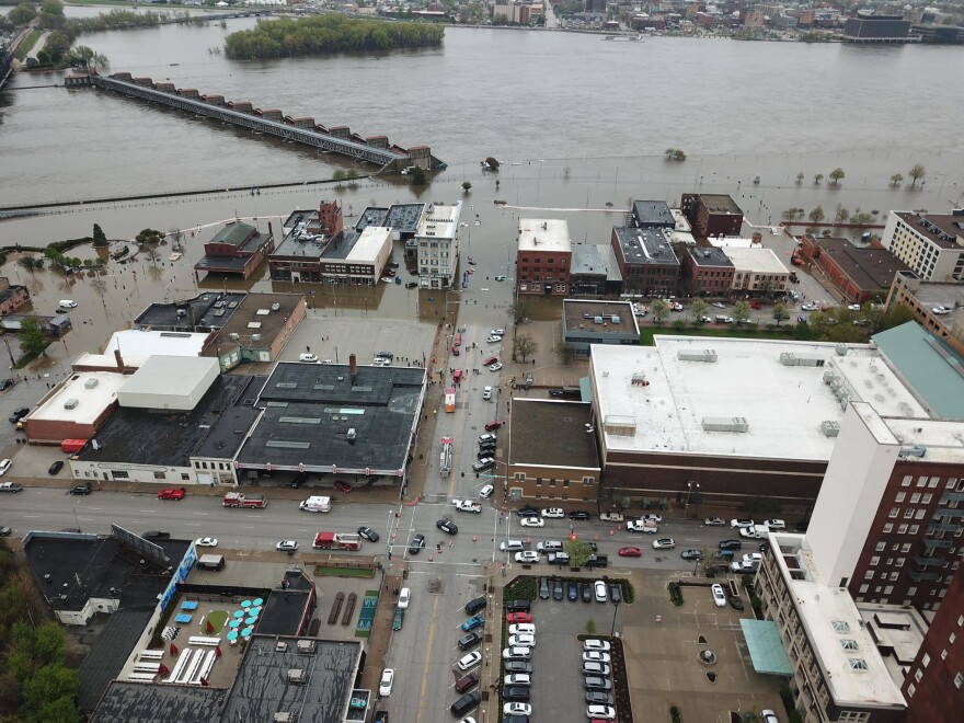
People who live and work along East 2nd Street in downtown Davenport are dealing with high water in their buildings after Tuesday afternoon's levee breach.
Michelle O'Neill reports the Mississippi River in the Quad Cities may tie the record crest set during the Great Flood of 1993.Radio story
Davenport Public Works Director, Nicole Gleason, says residents and businesses had about one hour warning before the temporary levee failed. City employees made and distributed sandbags throughout the night and continued those efforts today.
MidAmerican Energy turned off electricity and gas to the homes and businesses affected by the breach. That's roughly from Government Bridge to Perry and Brady streets including the Peterson Paper building, Front Street Brewery, and the Bucktown Center.
Dave Donovan, head of the Scott County Emergency Management Agency, says three people stayed overnight at a Red Cross shelter set up at a Davenport school. About 30 were evacuated from their homes on Tuesday. He emphasized that according to the National Weather Service in the Quad Cities, the high water and threat of flooding will continue for up to 30 days.
In about a week, Donovan and his staff plan to set up a one-stop shop for residents and businesses to apply for flood assistance. The county and city are working with many nonprofits, companies, and other governments who've offered to help with flood response and recovery.
Since 1993, many buildings on and near Davenport's riverfront have been moved or improved to be more resistant to flooding.

This year, the Mississippi River flood in the Quad Cities has already broken records for number of days the water has been at or above major flood stage at 39 days (as of today, 5/1/2019).
It's forecast to crest 7.4 feet over flood stage today.
That's only a few of inches lower than the all-time highest crest of 7.6 feet in July, 1993.
May 1st, 2019 National Weat... by on Scribd


Copyright 2019 WVIK, Quad Cities NPR

